History of 442 Lafayette Street
Prior to taking and demolition by Onieda County, this property was envisioned as a design component of the Wynn-BUD Initiative and later as the 442 Med-Health building.
June 29, 2022 - Sad day, cira. 1835, gone in under five hours...
Their #wynn #hospital destruction continues... demolished June 29, 2022, R.I.P. 442 Lafayette Street / 112 Fayette Street as Oneida County's @AJPicenteJr destroyed 187-years of Downtown @CityofUtica history in under five hours...https://t.co/i3qsuJxLMi pic.twitter.com/AjIkPqaYgZ
— #NoHospitalDowntown (@NoHospitalDwtn) July 4, 2022
Spotlight on a Landmark
442 Lafayette Street
The Bington/Isele House (Circa.1835)
By Michael Lehman, AIA
[Note: The following research is largely Mr. Lehman's work from his "Spotlight on a Landmark", which first appeared in The Landmarks Society of Greater Utica's April/May 2018 Preservation newsletter. Better Utica Downtown and #NoHospitalDowntown are working to add additional material to further educate and build Utica's remembrance of the historic Columbia Lafayette Neighborhood.]
Immediately west of the Genesee Street Central Business District (CBD) lies a district rich in history that reflects the various stages of growth which occurred as the village of Old Fort Schuyler, established in 1758, evolved into the City of Utica. By 1920, at its peak, the city was a Bustling Metropolis with greater than 100,000 inhabitants. Ready access to transportation has always supported the growth of the historic Columbia Lafayette Neighborhood- be it river, stagecoach, canals, railroad, trolley, or highways.
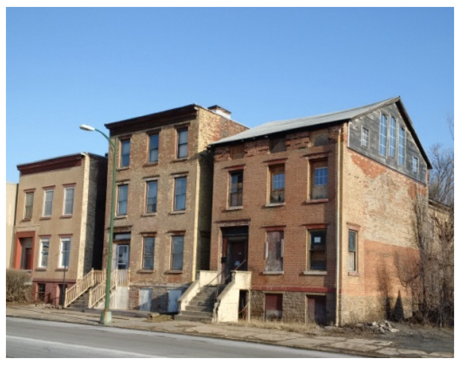
Shown above (center), 442 Lafayette Street (previously 112 Fayette Street) is one of three remaining townhouses on a thoroughfare once lined with similar dwellings. These three structures are the last evidence of their existence. They are part of only a handful of examples of early-19th century residential buildings remaining in Utica.
In addition, The Bington/Isele House is located in the Gateway Historic Canal District (GHCD) which was originally identified by a 2005 Peter J. Smith & Co. study commissioned by the city of Utica GHCD Revitalization Plan steering committee. It is, along with #440 and #444, eligible for the National Register of Historic Places according to the New York State Historic Preservation Office (SHPO). As the 200th anniversary of its construction approaches it still provides a glimpse into life in early Utica, New York State, and our young nation.
In 2016 The Landmarks Society of Greater Utica included the #440-444 Lafayette Street townhouses on its "Sixteen to Save" endangered buildings list.
Utica’s Early Days, the 1806, 1835 & 1839 Maps
An 1806 map of Utica depicts the fledgling settlement as only a crossroads at Bagg’s Square with several houses lining each side of the roads. By 1816 Liberty Street had been laid out at the edge of the village. Court Street which paralleled Liberty Street lay further south and was first known as Old Whitesboro Road as it originated as the old Indian trail leading westward.
A rectilinear street grid soon developed between the two roadways as the village grew rapidly aided by several stagecoach lines. New street names such as Liberty and Columbia reflected the patriotic pride of our newly founded country.
Others honored early landowners and their family, such as Cooper (named for Appollos Copper who originally owned much of the land in the neighborhood including the #442 site), Charles, Cornelia and Sayre. Eastern sections of Cooper and Spring Streets were eliminated for the City Hall and Kennedy Plaza Apartments urban renewal projects.
These maps of the stagecoach and early canal era neighborhood revealed blocks of freestanding residences of Utica’s early citizens built with their business on the first floor or very nearby. This arrangement was necessary in the days of the walking city when compactness and closeness to the city center were the goals. Smaller side streets and alleys- Pine Street, Sayre Alley, Butternut Lane, Carton Alley, Rome Street, and Madison Lane developed perpendicular to the main through fares. Even prominent citizens lived close to their businesses.
Alfred Munson, forebear of the founders of MWPAI and president of the Oneida Bank, lived on the west side of Broadway between Columbia & Lafayette Streets. Neighborhood residents’ occupations ranged from butcher & baker, to soap & candle maker, agent for the Utica & Schenectady Railroad, carpenter, coach maker, constable, church sexton, cordwainer (shoemaker), looking glass manufacturer, music teacher, physician, and V.P. of Temperance Society co-existing with a “distiller of spirits”.
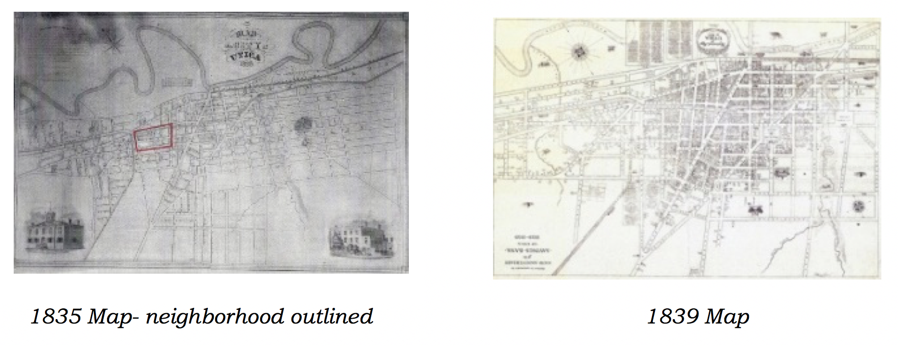
1835 Map- Neighborhood Outlined | 1839 Map
With the completion of the Erie Canal in 1825 the Columbia Lafayette Neighborhood found itself Right On The Canal Banks and began transitioning from a primarily residential area to one that attracted businesses that benefited from being near the canal for transporting raw materials and finished goods to market.
Neighborhood & Site Timeline
1798 - Rev. Timothy Dwight, president of Yale College, touring through the Mohawk Valley described Old Fort Schuyler as “a pretty village containing 50 houses”.
1815 - Ephraim Hart a merchant, iron manufacturer, director of the Bank of Utica, Erie Canal commissioner, and Hamilton College trustee built a large brick Federal style home on Lafayette Street near Cornelia Street. Other residences, churches, and small hotels were built during early 1800s in the Federal and Greek revival styles popular in the new nation at the time.
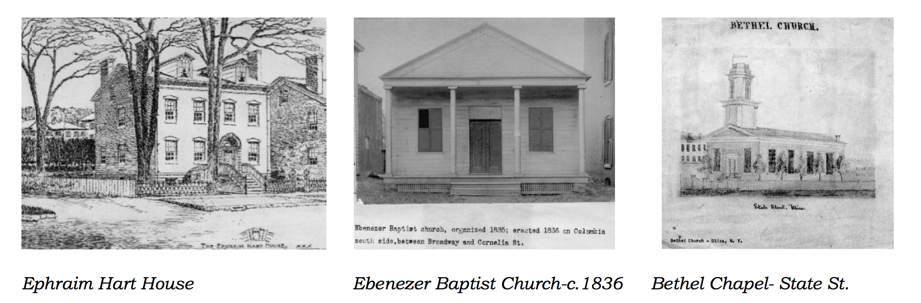
Ephraim Hart House | Ebenezer Baptist Church-c.1836 | Bethel Chapel- State St.
1823 - One of Utica’s first industries- Alfred Munson opened a small shop for the manufacture of millstones and mill equipment at Hotel & Liberty Streets.
1825 - Erie Canal opened. Utica’s first industries began to cluster on the banks of the Erie Canal which passed just to the north of the area- including various foundries, lumberyards, coal yards, machine shops, and horticultural nurseries. Lafayette Street, previously named Rome Street, was renamed in honor of General Marquis de Lafayette whose carriage rolled down this thorough fare in 1825, past the future site of #442, traveling from a canal boat landing in Whitesboro to a luncheon held at the Bagg’s Hotel in the General’s honor. Lafayette was touring the newly opened engineering marvel.
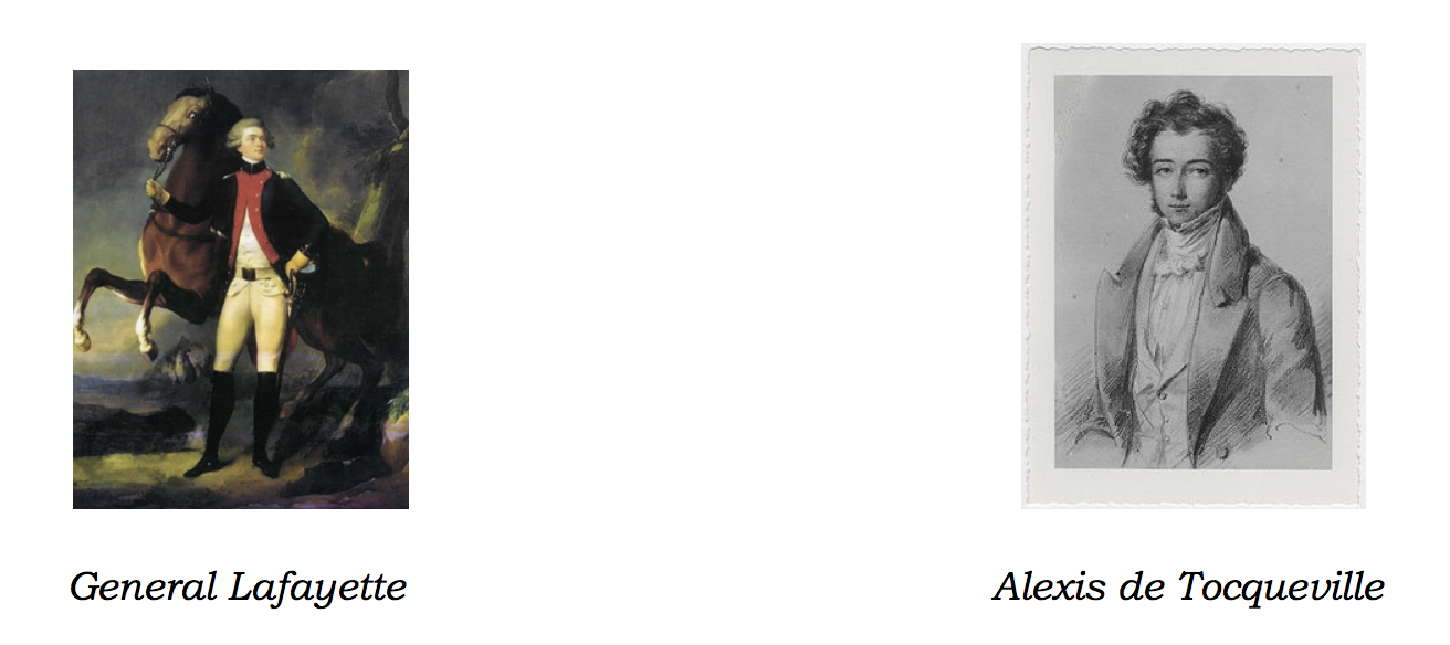
General Lafayette | Alexis de Tocqueville
1831 - Alexis de Tocqueville (author of On Democracy in America) passed through Utica during his visit to the US to study prisons. He commented on the pleasant appearance of the village, its fine shops and residences- noteworthy praise coming from a French nobleman used to traveling in the aristocratic circles of Paris.
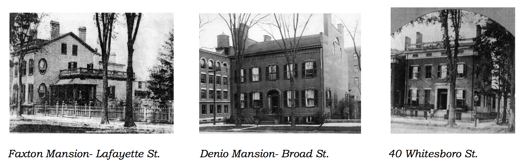
Faxton Mansion- Lafayette St. |Denio Mansion- Broad St. | 40 Whitesboro St.
1834 - Chenango Canal [Wikipedia] opened, crossed by vehicular bridges at Columbia & Lafayette Streets. State Street dead-ended north end at a large turning basin where the Erie and Chenango Canals connected.
1835 - Townhouses including #442(112) were built along Lafayette Street near State Street, possibly on speculation, to accommodate the new city’s rapidly growing population.
Evidence of this once elegant residential enclave can be seen in vintage photos (below) and is still visible at 440 to 444 Lafayette Street - the only three townhouses remaining from a cohesive residential block that existed from the early 1800s to the 1960s.
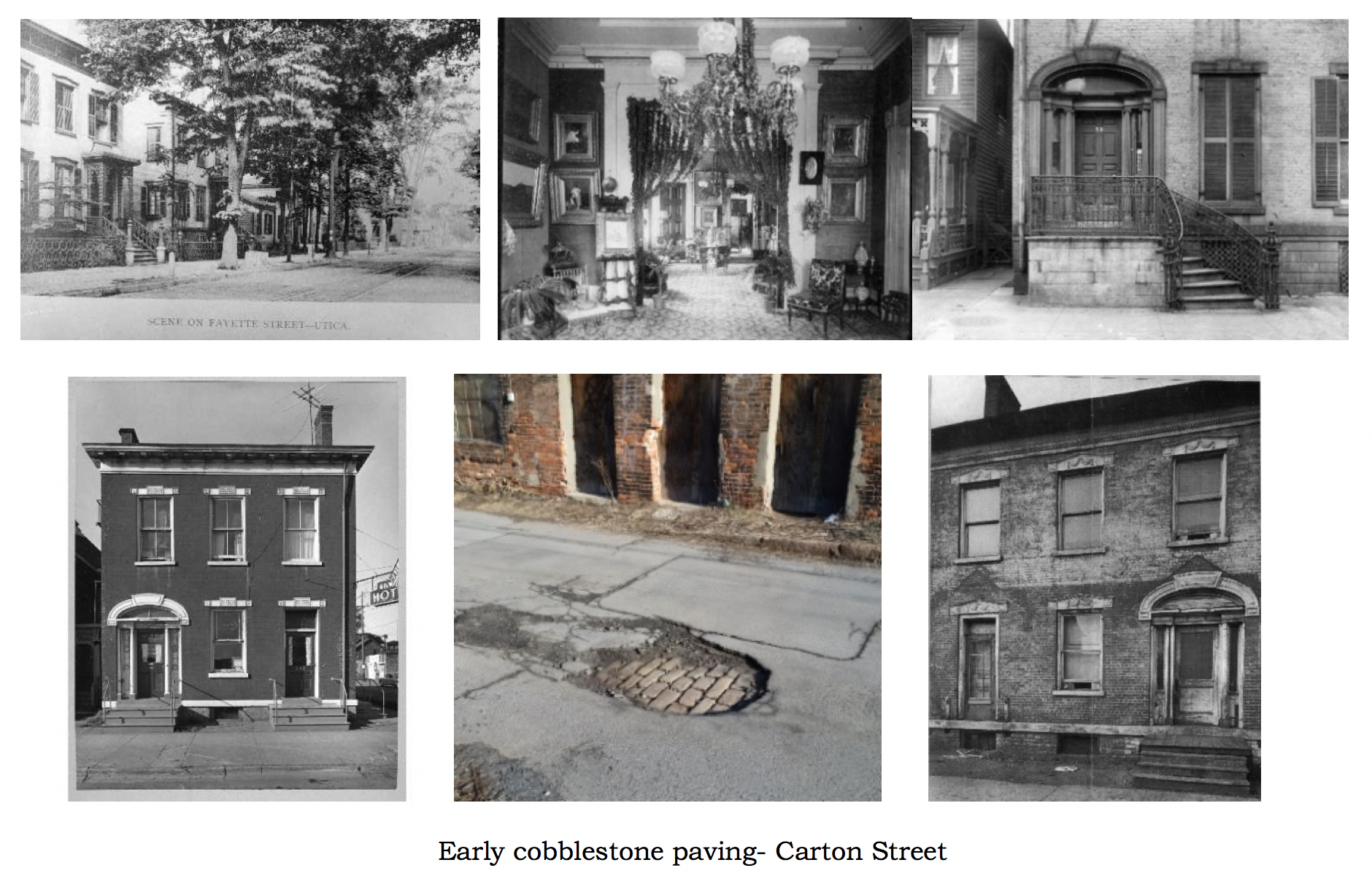
Bottom (center) reveals early cobblestone paving of Carton Street as seen today.
442 Lafayette Street was a classic freestanding, two story, three bay, Greek revival style, brick townhouse built on a raised limestone basement story. A masonry front stairway ascended to the principle floor and its Greek revival style front door with glass sidelight and transom above. Simple but refined lintels topped window and door openings. A small front garden spanned the front of the building to the right of the front stoop. In its early days it may have had a gable roof with three small attic windows facing the street, similar to #440 next door.
A subsequent owner appears to have added a third story. Maps of the period indicate the existence of a rear yard and garden with outbuildings fronting onto the alley at the rear of the lot. The alley was originally called Rome Street and then named Carton Street in honor of John Carton, who invented and began manufacturing a hot air furnace nearby in 1847. His grandson Matthew Carton was a major proponent and donor for the 1914 relocation of St. Elizabeth’s Hospital to South Utica. Carton Street’s early cobblestone paving is still visible under later asphalt layers.
1837 - Utica & Schenectady Railroad opened. The line terminal was near Bagg’s Square
1839 - Utica & Syracuse Railroad opened. The Fayette House hotel (located at the northeast corner of Lafayette and State Street) and T. Dean, a blacksmith, resided adjacent to the site of 442 Lafayette Street.
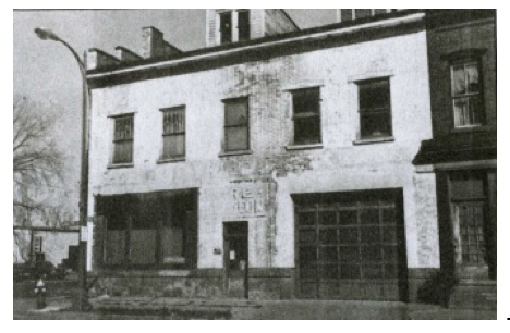
Fayette House (c. 1830s) - now gone, photo c. 1976
1848 - After a period of economic stagnation new steam knitting mills powered by Pennsylvania coal supplied via the adjacent Chenango canal opened near the neighborhood. German immigrants fleeing the Revolution of 1848 found ready employment in the Globe Woolen Mills, Utica Steam Cotton Mills, and Utica Steam Woolen Mills located within the surrounding blocks.
1851 - First Presbyterian congregation built a new Gothic Revival style church at Columbia & Washington Streets. Minard La Fever, a renowned church architect of the time, was the designer. Utica National Insurance Company occupies the site today.
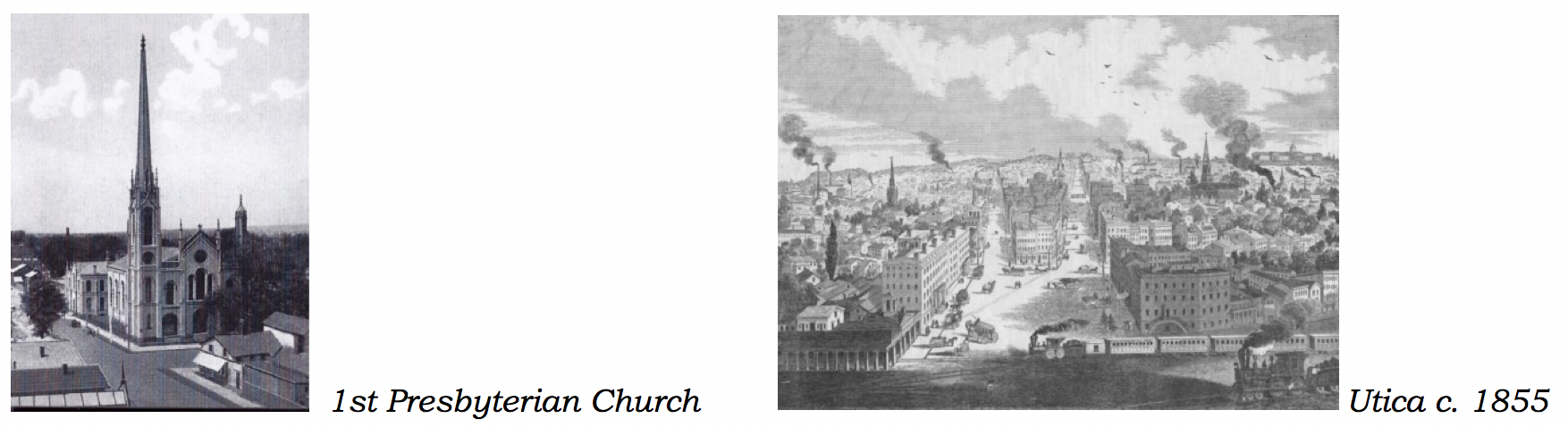
1st Presbyterian Church | Utica c. 1855
1863 - Utica horse drawn trolley service on Genesee Street started. Utica had the fifth trolley system in the US.
1873 - Visit this link, to view a Bird's eye view of the city of Utica, Oneida County, New York 1873, and a cropped portion of this map below...
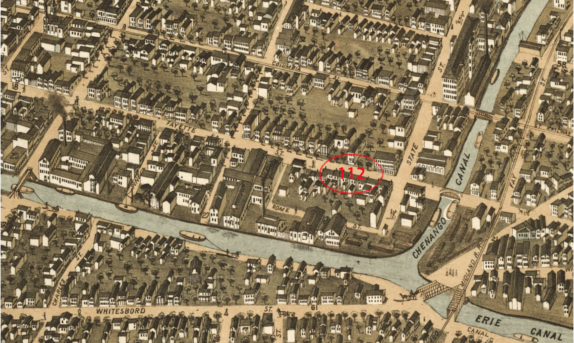
#112 circa. 1873 in targeted #mvhsdowntown site
1883 - #110(440) was occupied by Louis Snyder
#112(442) - C. S. Bington resided here, now 442 Lafayette Street occupation not listed.
#114(444) - Was owned by Edward C. Milgate. He owned a window shade/wallpaper store (see ads). Milgate still listed at 114 in 1889.
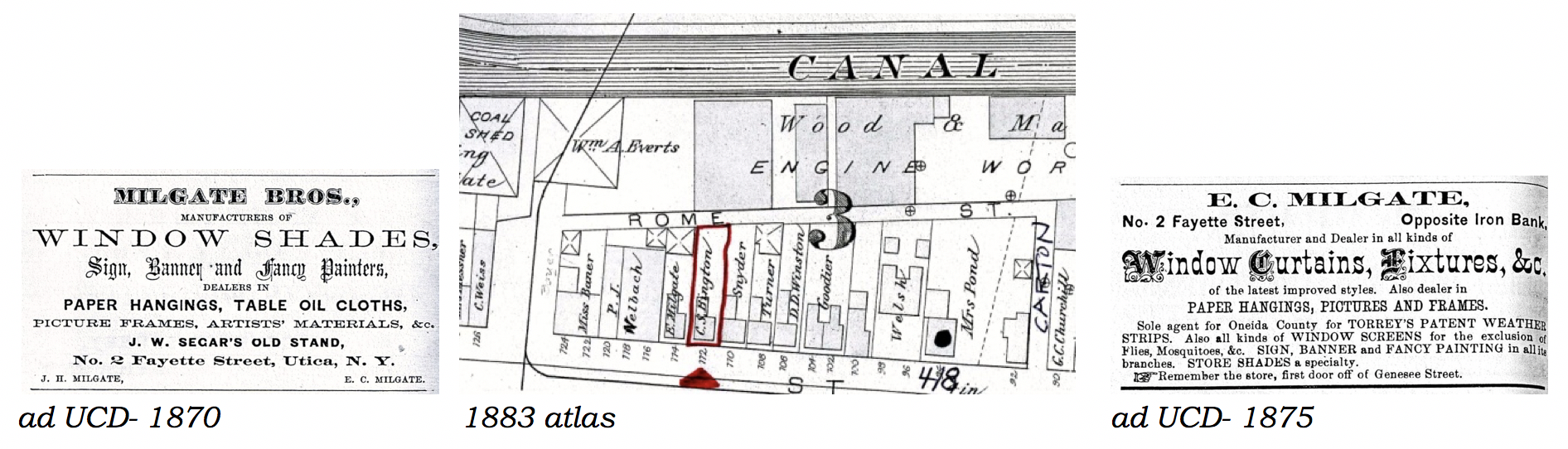
ad UCD- 1870 | 1883 atlas | ad UCD- 1875
1884 - Below is a section taken from Image 14 of Sanborn Fire Insurance Map from Utica, Oneida County, New York, showing 112 Fayette Street, today known as 442 Lafayette Street...
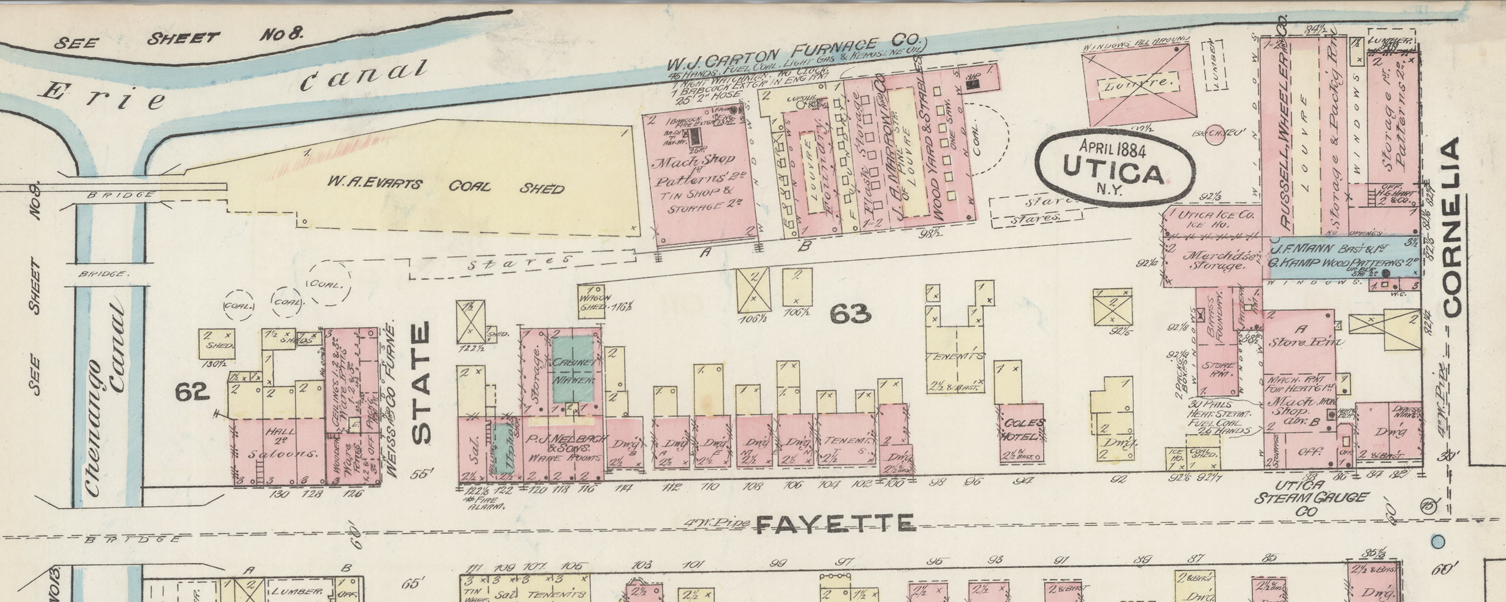
1884 Map of 112/#442 & Surrounding Buildings
Shown centered and under Fayette Street (now Layfatte Street), is a 4" waste pipe, indicating "modern" indoor plumbing was in place.
1890 - Electric trolley service started. The Utica Belt Line RR trolley system served the area with lines running from Genesee Street along Lafayette and Columbia Streets, then up State Street to Lincoln Avenue. #442 was on the Lafayette Street line. By this time Columbia Street which previously terminated east at Broadway had been extended to meet Genesee Street.
1892 - Mrs. M. Williams listed at #112 and at #114 Charles T. Currier, a dyer resided here with his son Charles, a clerk.
By the late 1800s the neighborhood was a mixed use district as evidenced by the listings in the 1897 Utica City Directory of 1897. New immigrant groups were arriving and adding to the diversity and vitality of the city. With the advent of the canal and commercial/industrial uses the precinct gradually started to lose its luster as a residential area but provided housing for workers in the nearby downtown businesses and mills on Court & State Streets, other factories, and the canal.
1894 - 110 Henry Zobel asst.undertaker at adjacent Nelbach’s, Lawrence Zobel- emp. casket works
112 Mrs. M. Williams
114 Charles T. Currier- hosiery manufacturer, Ilion, NY
1896 - Utica Atlas showed freestanding wooden & brick residences on Lafayette to Washington Streets, west to State Street.
1898 - 110 PJ & JB Nelbach- furniture & undertakers, Henry Nobel- laborer
112 No listing
114 Arthur D. Barr- clerk
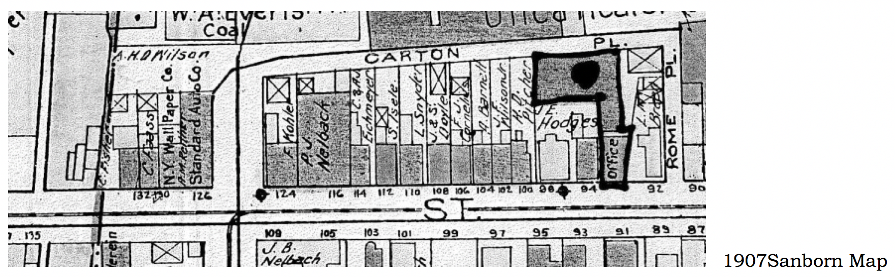
1899 - In Image 34 of Sanborn Fire Insurance Map from Utica, Oneida County, New York), we see more changes that occurred since the 1984 map shown above; (1) Fayette has become Lafayette Street, (2) one sees Rome Street and Carton Avenue have been constructed, also (3) this larger map shows (further to the north) the "International Heater Co. - Carton Plant" along side the Eire Canal...
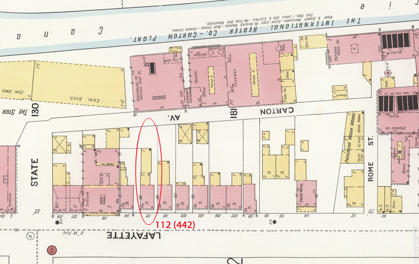
1899 Map of 112/#442 & Surrounding Buildings
Today the Columbia Lafayette Neighborhood has 418 Lafayette Street (#94 Lafayette St. on map), which housed the Carton Furnace Company and had become part of International Heater Company in 1897.
1907 - 110 Louis Snyder- Snyder Bros. men’s furnishings, Louis Wineburgh- broker 112 Siegfried Isele- carpenter, boarder -Nellie Anderson (widow of Andrew) 114 Catherine C. Eichmeyer- dressmaker
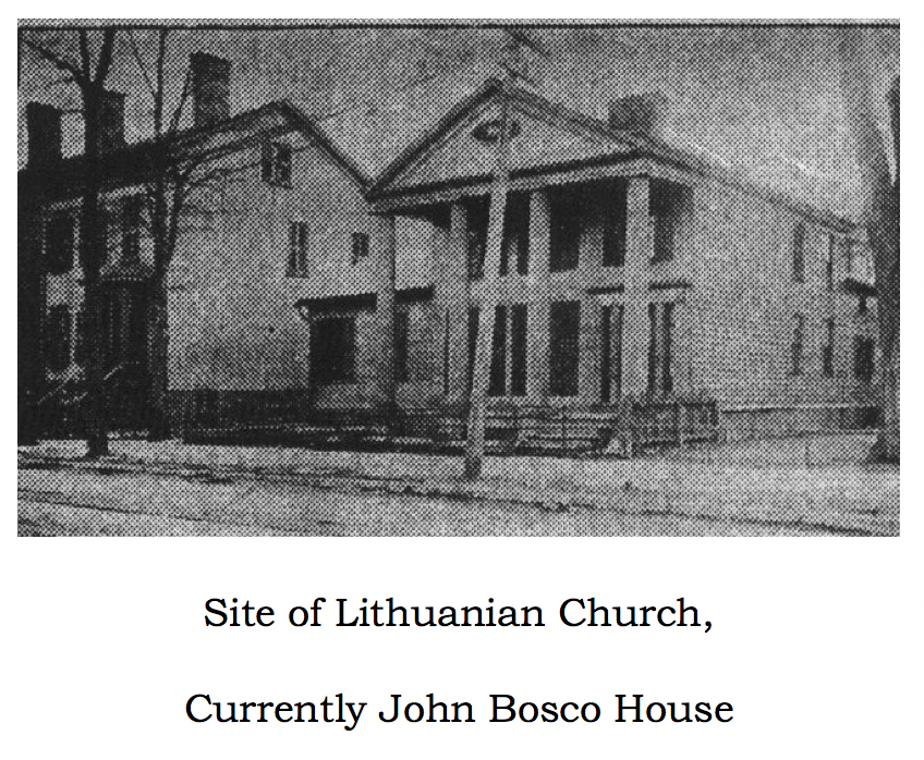
1911 - St. George’s Lithuanian Church opened across Lafayette Street on site of Greek revival style house. Site of Lithuanian Church- currently John Bosco House.
1914 - Fayette Street renamed Lafayette Street, street numbering system changed.
#440 Hyman Cohen- butcher
#442 Siegfried Isele- Carpenter, Benjamin D. Williams
#444 Catherine C. Eichmeyer- dressmaker
Movie theaters made their début along Lafayette Street near Genesee Street...
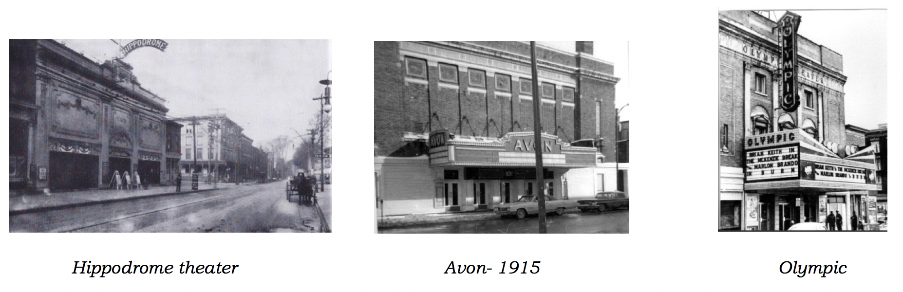
Hippodrome theater | Avon- 1915 | Olympic
1920 - #440 Hyman Cohen- meat wholesaler, Mrs. Margaret Heaney
#442 Siegfried Isele- carpenter, Edward Leonard- laborer, Anna. B. Kelly, John Clark
#444 Henry Near- mason
1929 - #440 Hyman Cohen- occupation cattle dealer, George & Florence Watkins- occupation driver
#442 3 apartments listed: Raymond A. & Katherine Gibbs- he was an electrician, Miss Mary Boehler, and a vacant unit.
#444 Lyle & Minnie Hinckley- his occupation listed as a mechanic
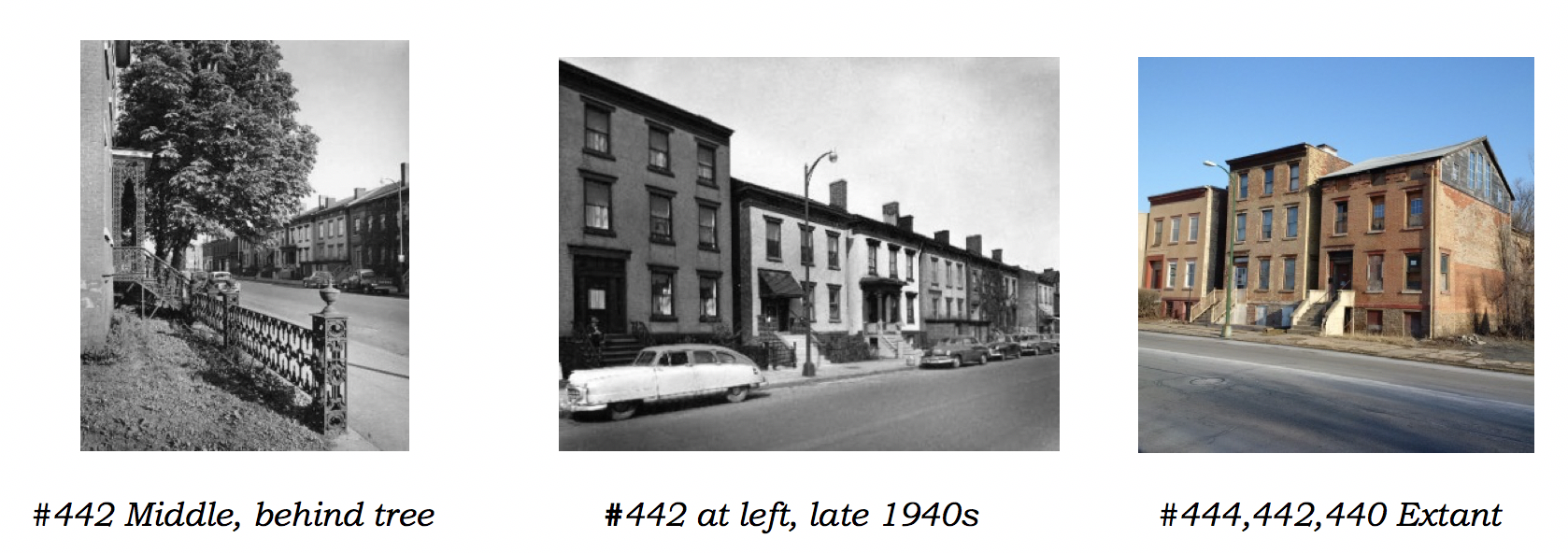
#442 middle behind tree | #442 at left, late 1940s | #444,442,440 Lafayette Street - extant
By the mid-1920s, one could buy almost anything in on Lafayette, Columbia, and surrounding streets- from apples at the Central Market and to mom & pop groceries (no food desert here) to furniture at E. Tudor Williams and wringer washing machines at H.D. Morehouse & Sons. Livery stables that had dotted the neighborhood gave way to parking garages, automobile dealerships, auto parts and auto repair businesses.
1940s - Like most downtowns, city directory neighborhood listings included businesses offering everything from baked goods to billiards, cars to clothing, dentistry to dry cleaning, electronics, flowers to furniture, hotdogs to hotels, shoes to shovels, pianos to paint to plumbing supplies, violin lessons to veterinary care, and everything in between. 1960s As part of the urban renewal movement proposed plans were developed but never realized for a SUNY technology institute campus (complete with underground parking garage) and a new governmental center. A downtown mall shopping center was also proposed but never built.
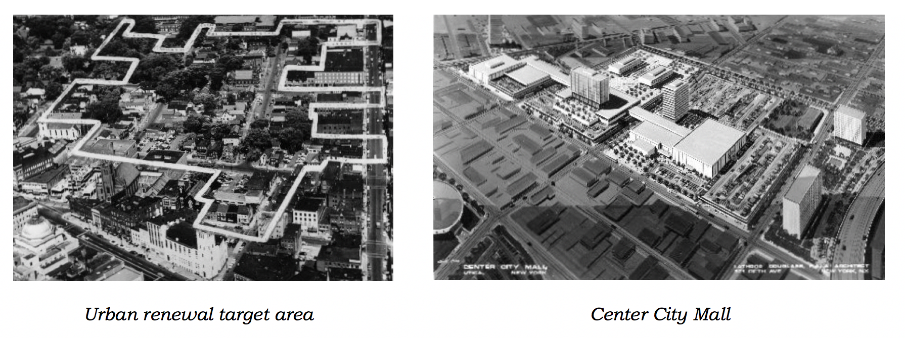
Urban renewal target area | Center City Mall
All that remains of those schemes are large holes in the urban fabric, vacant lots awaiting development, two high maintenance deteriorating parking structures that were intended to be built upon and Columbia Street garage storefronts that never fully realized their intended potential and add little to the life and vibrancy of the adjoining neighborhood.
2005 - More historic urban fabric was lost when buildings are demolished to accommodate parking for the police station support facilities and new Utica City Courts, which 13 years later may be relocating due to the proposed MVHS downtown hospital. Urban design efforts to date do not appear to be part of a larger, coordinated, long term, implementation plan.
2015 - MVHS began to consolidate Utica’s three hospitals into one, proposing several site options and selecting a downtown site should it prove financially feasible.
2017 - Despite the Landmarks Society previously raising concerns regarding the neighborhood’s historic buildings during community input meetings, the MVHS 30% site plan showed #442 and all other existing buildings as being demolished for surface parking and a four story parking garage.
2018 - New owner purchases Historic #442 to rescue this valuable economic asset from the threat of obliteration. His vision for a livable, walkable neighborhood reflects the guidelines established in the 2005 Peter Smith & Co. Gateway Historic Canal District Study. In that study #442 was highlighted as an example of the scale, massing, and proportions that should be strived for in new in-fill construction.
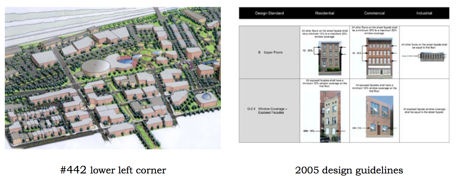
#442 lower left corner | 2005 design guidelines
Conclusion
Many exciting challenges & opportunities present themselves as our landmark #442 townhouse and its surrounding neighborhood enter the next stage of their development.
It is critical that this centrally located area be put to its highest and best use for enterprises that require and would most benefit from immediate adjacency to the downtown CBD, the Auditorium, two hotels and the city hall/police station precinct. Such development should also support the goals of the 2011 Utica sustainable Master Plan.
Urban design & planning thinking in 2018 has changed dramatically since the urban renewal blocks of the 1960s & 70s. Today’s visions should reflect current progressive approaches such as the New Urbanism and Reurbanism and support the economic revitalization that has already started in the neighborhood. To date the proposed DT hospital plans have only resulted in stifling and halting economic development that was already underway and resulting in at least one business leaving the city and relocating to the suburbs.
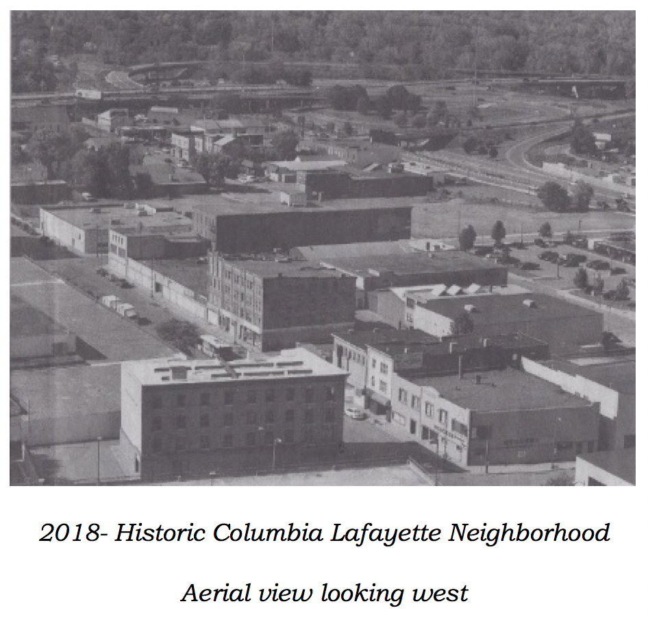
2018- Historic Columbia Lafayette Street neighborhood (aerial view looking west)
A 2014 study by the Preservation Green Lab of the National Trust for Historic Preservation notes that the character of buildings and blocks directly influences urban economic growth & vitality. They found that older, smaller scale buildings and blocks “punched above their weight class”. In comparison to newer, larger, less age-diverse mega blocks they were better at creating more new jobs per square foot, more jobs were created in small businesses, and more new non-chain, local businesses opened. (For an executive summary and the complete report see Green Lab).
It makes sense to build on the nucleus of viable businesses that currently operate in the neighborhood and blend them with new infill construction that will expand the adjacent mixed use building types, include housing, that are currently contributing to the revitalization of the Bagg’s Square area. This would help to creating the critical mass of resident consumers necessary to financially support the grocery stores, bakeries, dry cleaners, pharmacies, theaters, shops, and other neighborhood amenities that are coveted by urban dwellers and that would further enhance the livability of a walkable Downtown.
Remarkable things can happen as greater Utica again reinvents itself if all opportunities and resources are identified and used to their greatest potential. We must build on our strengths, especially our rich history and unmatched architectural heritage- an approach that fortunately the new owner of #442 recognizes, embraces and is putting into action.
Sources
Building Structure Inventories-various authors -Division for Historic Preservation NYS Parks & Recreation, 1978.
Clark, T. Wood. Utica for a Century and a Half. Utica, NY: The Widtman Press, 1952.
Illustrated Utica. 1890.- Scene of Fayette Street- Utica
Klossner, Joan. Utica Streets; A Stroll into History. Utica, NY: Oneida County Historical Society.
Older, Smaller, Better- Measuring how the character of buildings and blocks influences urban vitality. National Trust for Historic Preservation- Preservation Green Lab study, 2014
Oneida County History Center- Vintage photos
Przybycien, Frank E. – Fayette House photo
Truett, Brett- Current neighborhood photos
Utica Atlas- 1896
Utica City Directories 1870 to1929
Utica Maps- 1806, 1835, 1839
Utica Observer Dispatch Archives
Utica Sanborn Map- 1908
We're not opposed to a new hospital... just don't bulldoze Downtown Utica's Historic Columbia-Lafayette Neighborhood... "Build It At St. Luke's!"