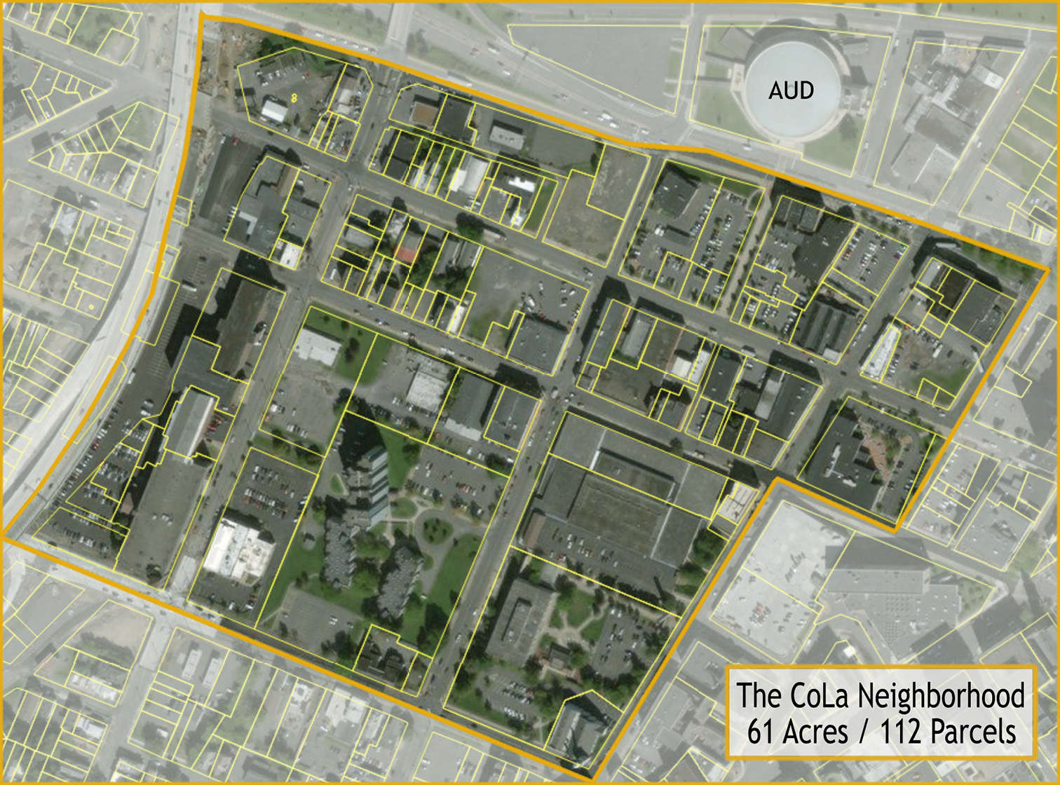
Spread over 61-acres, CoLa is divided into 112 parcels that current host 57 buildings and structures. View the present day map of CoLa's Parcels in Downtown Utica.
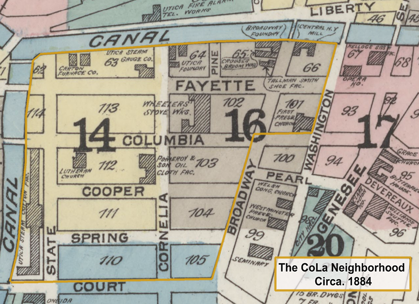
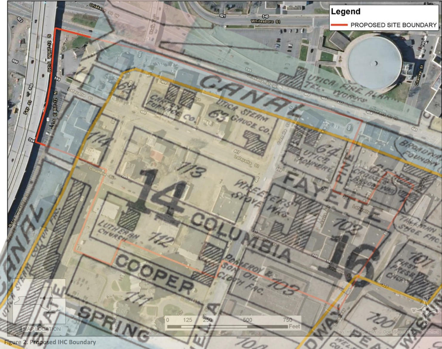
View a 1884 map of Downtown Utica and the CoLa Neighborhhod: Circa. 1884.
Do you know what streets remain and which alley's are gone? Get to know The Streets of Cola. Here are the recent Cola-area Traffic Counts according to the NYS DOT.
Taxes on real estate are the life blood of a city, downtown urban cores hold great promise. For example, watch a short video by Urban3, and "Do The Math", then view the Downtown Utica Tax Maps Of The Cola Neighborhood.
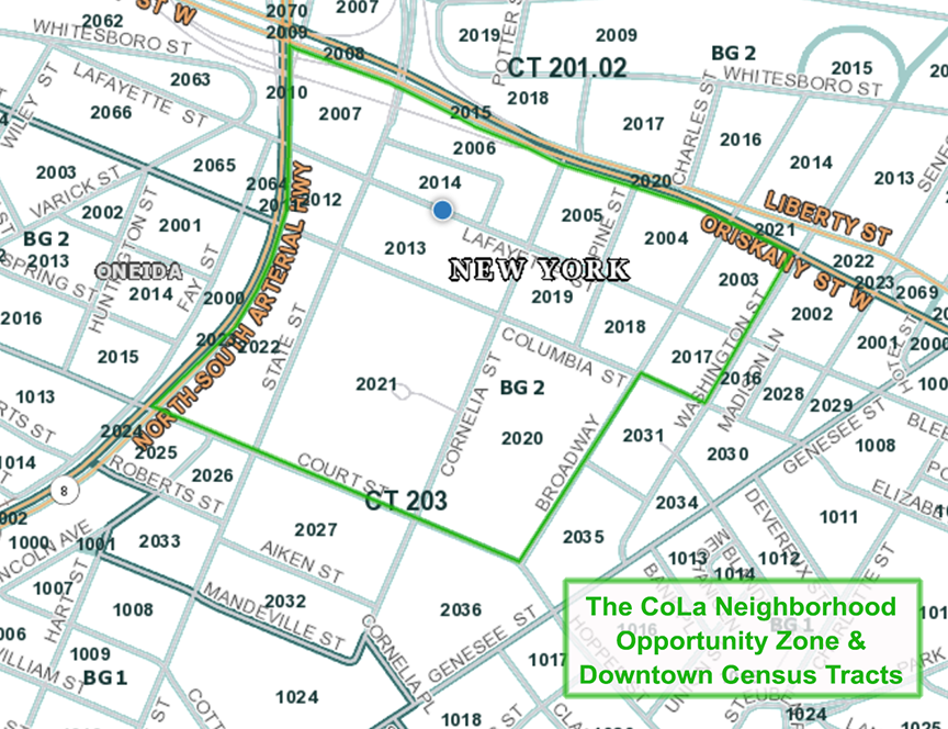
Cola is in a New York State "Opportunity Zone", Federal area targeted for investment. View Downtown Utica's Cola Opportunity Zone Map.
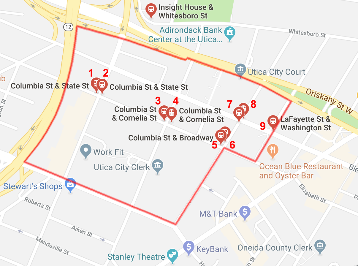
Public bus stops within the Cola Neighborhood number nine; "Centro Bus Stops Map", plus link to Cola Bus Stops On Google.
Consider this: Not perfect, view Old Streets & Canals, Plus Today's Streets, but there's history to celebrate!